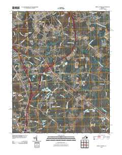
2010 Map of Prince George
USGS Topo · Published 2010About this map
New Bohemia and the surrounding Prince George countryside appear here as a landscape of expanding residential estates and historic swamp drainage. The area is defined by the headwaters of the Blackwater Swamp and Second Swamp, which are dotted with small impoundments such as Hanzliks Pond, Jandls Pond, and Bakers Pond. Numerous family-named landmarks and cemeteries, including Union Branch Cemetery and Sacred Heart Cemetery, provide valuable anchor points for genealogists. To the west, the suburban fringes of Petersburg press against the military boundaries of Fort Lee, where the Fort Lee Post Office and Fort Lee Golf Course are situated. The map illustrates the 21st-century transition of this Virginia tidewater region from a rural patchwork of woods and farms into a structured network of named subdivisions like Flactem Manor and Ethridge Estates.
Find a feature on this map
103 named features on this map. Tap any name to fly to it.
Don’t see what you’re looking for? This feature index may not catch every label — zoom into the map to look around manually.
Map Details
Editions of this 2010 Prince George Map
This is the sole edition of this map. No revisions or reprints were ever made.
Other maps of this area

1894 · Bermuda Hundred
USGS Topo · 1:62,500

1894 · Petersburg
USGS Topo · 1:62,500

1918 · Charles City
USGS Topo · 1:62,500

1919 · Disputanta
USGS Topo · 1:62,500

1943 · Hopewell
USGS Topo · 1:31,680

1943 · Disputanta
USGS Topo · 1:31,680

1943 · Richmond
USGS Topo · 1:250,000

1944 · Reams
USGS Topo · 1:31,680
1944 · Chester
USGS Topo · 1:31,680
1944 · Petersburg
USGS Topo · 1:31,680