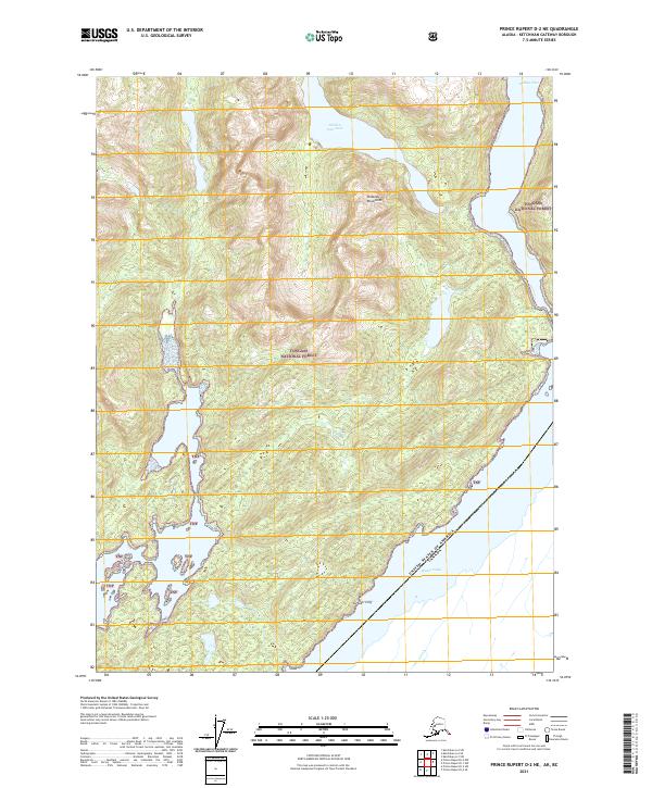
2021 Map of Prince Rupert D-2 NE
USGS Topo · Published 2021About this map
Tongass National Forest dominates this coastal Alaskan landscape where the international border separates the United States from Canada along the deep waters of Pearse Canal. The terrain is defined by the steep elevations of the Peabody Mountains and the dramatic drop of Gétukti Cliff, falling toward the tidewaters. This 2021 update documents the intricate shoreline and drainage patterns of the Hidden Inlet area, including the significant freshwater reservoir of Hidden Inlet Lake. The map reveals a land almost entirely under federal management, where the absence of roads or permanent settlements highlights the wilderness character of the Ketchikan Gateway Borough. The maritime boundary in the canal underscores the region's strategic position at the southern edge of Alaska's Panhandle, providing a precise record of the natural coastline and topographic relief as it exists today.
Find a feature on this map
13 named features on this map. Tap any name to fly to it.
Don’t see what you’re looking for? This feature index may not catch every label — zoom into the map to look around manually.
Map Details
Editions of this 2021 Prince Rupert D-2 NE Map
This is the sole edition of this map. No revisions or reprints were ever made.
Other maps of this area

1951 · Prince Rupert
USGS Topo · 1:250,000

1952 · Ketchikan
USGS Topo · 1:250,000

1955 · Ketchikan A-2
USGS Topo · 1:63,360

1955 · Ketchikan A-1
USGS Topo · 1:63,360

1955 · Prince Rupert D-2
USGS Topo · 1:63,360
1955 · Prince Rupert D-1
USGS Topo · 1:63,360

1955 · Ketchikan
USGS Topo · 1:250,000

1959 · Prince Rupert
USGS Topo · 1:250,000

1964 · Prince Rupert
USGS Topo · 1:250,000
2018 · Ketchikan A-1 SW
USGS Topo · 1:25,000