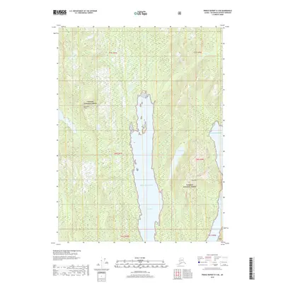
2018 Map of Prince Rupert D-3 NE
USGS Topo · Published 2018About this map
Tongass National Forest dominates this coastal landscape in the Ketchikan Gateway region of Alaska. The area is defined by the deep waters of Nakat Inlet and the Pacific Ocean, which carve into the steep, timbered terrain. Topographic landmarks like Peninsula Ridge and Shed Mtn rise sharply from the shoreline, illustrating the vertical character of the Alexander Archipelago. Inland, Nakat Lake provides a notable freshwater contrast to the surrounding saltwater channels. The map reflects a modern era of forest management and maritime preservation, where traditional land divisions such as t80s r98e intersect with the protected boundaries of the nation's largest national forest. This survey is a record of the complex shoreline and high-elevation contours that govern navigation and land use in this part of Southeast Alaska.
Find a feature on this map
12 named features on this map. Tap any name to fly to it.
Don’t see what you’re looking for? This feature index may not catch every label — zoom into the map to look around manually.
Map Details
Editions of this 2018 Prince Rupert D-3 NE Map
This is the sole edition of this map. No revisions or reprints were ever made.
Other maps of this area

1951 · Prince Rupert
USGS Topo · 1:250,000

1952 · Ketchikan
USGS Topo · 1:250,000

1955 · Ketchikan A-2
USGS Topo · 1:63,360

1955 · Prince Rupert D-3
USGS Topo · 1:63,360

1955 · Ketchikan A-3
USGS Topo · 1:63,360

1955 · Prince Rupert D-2
USGS Topo · 1:63,360

1955 · Ketchikan
USGS Topo · 1:250,000

1959 · Prince Rupert
USGS Topo · 1:250,000

1964 · Prince Rupert
USGS Topo · 1:250,000
2018 · Ketchikan A-3 SW
USGS Topo · 1:25,000