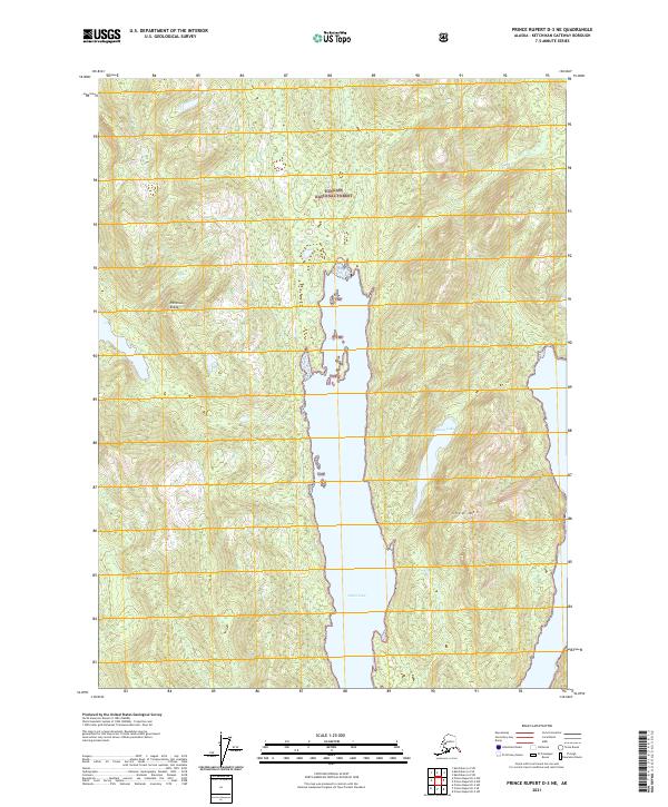
2021 Map of Prince Rupert D-3 NE
USGS Topo · Published 2021About this map
Nakat Inlet dominates this coastal survey, cutting deep into the coastal terrain of the Tongass National Forest. The waterway is flanked by dramatic elevation changes, with the high ground of Peninsula Ridge rising to the west and the heights of Shed Mtn to the east. This 2021 edition provides a detailed contemporary look at the uninhabited landscape within the Ketchikan Gateway Borough, where the tidal waters of the inlet meet the secluded Nakat Lake. The map illustrates the complex hydrography and steep contours of the Alexander Archipelago, showing a wilderness preserved without road access or modern development. This coastal corridor is primarily defined by its natural boundaries and federal forest designations, reflecting the enduring character of this remote Alaskan panhandle region.
Find a feature on this map
12 named features on this map. Tap any name to fly to it.
Don’t see what you’re looking for? This feature index may not catch every label — zoom into the map to look around manually.
Map Details
Editions of this 2021 Prince Rupert D-3 NE Map
This is the sole edition of this map. No revisions or reprints were ever made.
Other maps of this area

1951 · Prince Rupert
USGS Topo · 1:250,000

1952 · Ketchikan
USGS Topo · 1:250,000

1955 · Ketchikan A-2
USGS Topo · 1:63,360

1955 · Prince Rupert D-3
USGS Topo · 1:63,360

1955 · Ketchikan A-3
USGS Topo · 1:63,360

1955 · Prince Rupert D-2
USGS Topo · 1:63,360

1955 · Ketchikan
USGS Topo · 1:250,000

1959 · Prince Rupert
USGS Topo · 1:250,000

1964 · Prince Rupert
USGS Topo · 1:250,000
2018 · Ketchikan A-3 SW
USGS Topo · 1:25,000