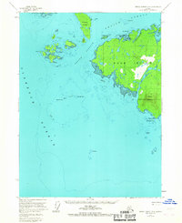
1955 Map of Prince Rupert D-5
USGS Topo · Published 1967About this map
Duke Island and its surrounding archipelago dominate this mid-century maritime survey, situated at the southern entrance to the Alaskan Panhandle. The landscape is characterized by a dense network of water passages, including Clarence Strait and Felice Strait, which facilitated coastal travel between the complex island groups. On the southern portion of Duke Island, Mount Lazaro serves as a prominent navigational landmark overlooking Cape Northumberland. Settlement is sparse, with only isolated Cabins noted along the irregular shoreline. The map also captures a portion of the Annette Island Indian Res to the northwest, highlighting the importance of indigenous land boundaries in this maritime region. Smaller island clusters like the Percy Islands and Hotspur Island are documented with hydrographic detail, including hazards such as Sealing Reef and Hassler Reef.
Find a feature on this map
40 named features on this map. Tap any name to fly to it.
Don’t see what you’re looking for? This feature index may not catch every label — zoom into the map to look around manually.
Map Details
Editions of this 1955 Prince Rupert D-5 Map
2 editions found
Other maps of this area

1948 · Prince Rupert D-6
USGS Topo · 1:63,360

1948 · Ketchikan A-6
USGS Topo · 1:63,360

1951 · Prince Rupert
USGS Topo · 1:250,000

1951 · Prince Rupert D-6
USGS Topo · 1:63,360

1952 · Ketchikan
USGS Topo · 1:250,000

1955 · Ketchikan A-4
USGS Topo · 1:63,360

1955 · Ketchikan A-5
USGS Topo · 1:63,360
1955 · Prince Rupert D-5
USGS Topo · 1:63,360
1955 · Prince Rupert D-4
USGS Topo · 1:63,360

1955 · Ketchikan
USGS Topo · 1:250,000