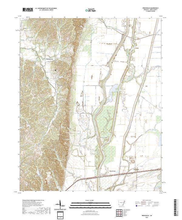
2024 Map of Princedale
USGS Topo · Published 2024About this map
Crowleys Ridge rises distinctly above the Arkansas Delta landscape on this 2024 survey, marking a geological divide between the higher western terrain and the low-lying wetlands of the St. Francis River basin. To the east of this ridge, the map reveals an intricate network of waterways including Saint-Francis Bay, Copeland Slough, and Lindley Slough, which dominate the rural drainage patterns. Small communities and historical sites are clustered along the ridge and the edges of the floodplains, such as Pleasant Hill and the river-adjacent River Front. Local history is preserved in sites like Akins Cem and Harefarm Cem, while the road network is punctuated by uniquely named local routes like Whiskey Store Rd and Billy Peeler Rd, which provide clues to the region's cultural geography.
Find a feature on this map
52 named features on this map. Tap any name to fly to it.
Don’t see what you’re looking for? This feature index may not catch every label — zoom into the map to look around manually.
Map Details
Editions of this 2024 Princedale Map
This is the sole edition of this map. No revisions or reprints were ever made.
Other maps of this area

1939 · Vanndale
USGS Topo · 1:62,500

1939 · Wynne
USGS Topo · 1:62,500

1940 · Princedale
USGS Topo · 1:62,500

1940 · Whitmore
USGS Topo · 1:62,500

1953 · Memphis
USGS Topo · 1:250,000

1956 · Memphis
USGS Topo · 1:250,000

1956 · Whitmore
USGS Topo · 1:62,500

1956 · Princedale
USGS Topo · 1:62,500

1958 · Wynne
USGS Topo · 1:62,500

1958 · Vanndale
USGS Topo · 1:62,500