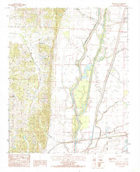
1984 Map of Princedale
USGS Topo · Published 1985About this map
Crowleys Ridge dominates the western landscape of this mid-1980s Arkansas survey, creating a sharp topographic contrast with the flat alluvial lowlands to the east. This geological formation serves as a natural upland where the settlements of Birdeye and Pleasant Hill are established, safe from the complex network of wetlands that define the rest of the quadrangle. The eastern half of the map is a maze of drainage and waterways, including the engineered Straight Slough and the winding St Francis Bay.
Find a feature on this map
16 named features on this map. Tap any name to fly to it.
Don’t see what you’re looking for? This feature index may not catch every label — zoom into the map to look around manually.
Map Details
Editions of this 1984 Princedale Map
This is the sole edition of this map. No revisions or reprints were ever made.
Other maps of this area

1939 · Vanndale
USGS Topo · 1:62,500

1939 · Wynne
USGS Topo · 1:62,500

1940 · Princedale
USGS Topo · 1:62,500

1940 · Whitmore
USGS Topo · 1:62,500

1953 · Memphis
USGS Topo · 1:250,000

1956 · Memphis
USGS Topo · 1:250,000

1956 · Whitmore
USGS Topo · 1:62,500

1956 · Princedale
USGS Topo · 1:62,500

1958 · Wynne
USGS Topo · 1:62,500

1958 · Vanndale
USGS Topo · 1:62,500