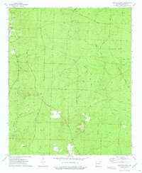
1973 Map of Princeton East
USGS Topo · Published 1975About this map
Princeton and its surrounding Dallas County countryside are defined by a complex network of timber and logging routes in the early 1970s. The landscape is heavily dissected by numerous watercourses including Boyd Creek, Red Branch, and Martin Creek, which shape the rural transport patterns. Distinctive local history is preserved in the naming of roads such as Eagle Tram Road, likely tracing an older rail corridor, alongside Tanyard Road and Zion Liberty Road.
Find a feature on this map
45 named features on this map. Tap any name to fly to it.
Don’t see what you’re looking for? This feature index may not catch every label — zoom into the map to look around manually.
Map Details
Editions of this 1973 Princeton East Map
2 editions found
Other maps of this area

1903 · Camden
USGS Topo · 1:125,000

1953 · El Dorado
USGS Topo · 1:250,000

1955 · Little Rock
USGS Topo · 1:250,000

1956 · Little Rock
USGS Topo · 1:250,000

1957 · El Dorado
USGS Topo · 1:250,000

1958 · El Dorado
USGS Topo · 1:250,000

1960 · El Dorado
USGS Topo · 1:250,000

1960 · Little Rock
USGS Topo · 1:250,000

1964 · Little Rock
USGS Topo · 1:250,000

1964 · Bunn
USGS Topo · 1:24,000