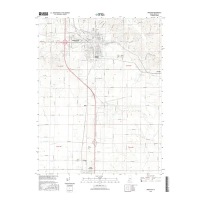
2016 Map of Princeton
USGS Topo · Published 2016About this map
The county seat of Princeton serves as the focal point for this Gibson County landscape, where urban street grids meet an extensive network of rural ditches and creeks. Established cemeteries like Archer Cem, Odd Fellows Cem, and Warnock Cem are clustered on the northern edge of the city, providing critical points of reference for genealogical research. To the south, the landscape transitions toward Fort Branch and Durham, showing a pattern of dispersed settlements and farmsteads characteristic of Southwestern Indiana. The drainage system is particularly well-documented, featuring Richland Cr and the complex of canals including McCarty Ditch and McGary Ditch that manage the low-lying terrain. Smaller communities such as King and Baldwin Heights illustrate the local residential expansion along the primary north-south transit corridors.
Find a feature on this map
42 named features on this map. Tap any name to fly to it.
Don’t see what you’re looking for? This feature index may not catch every label — zoom into the map to look around manually.
Map Details
Editions of this 2016 Princeton Map
This is the sole edition of this map. No revisions or reprints were ever made.
Other maps of this area

1901 · Princeton
USGS Topo · 1:62,500

1901 · Haubstadt
USGS Topo · 1:62,500

1902 · Ditney
USGS Topo · 1:125,000

1902 · Boonville
USGS Topo · 1:62,500

1903 · Haubstadt
USGS Topo · 1:62,500

1903 · Petersburg
USGS Topo · 1:62,500

1903 · Princeton
USGS Topo · 1:62,500

1903 · Patoka
USGS Topo · 1:125,000

1956 · Vincennes
USGS Topo · 1:250,000

1957 · Vincennes
USGS Topo · 1:250,000