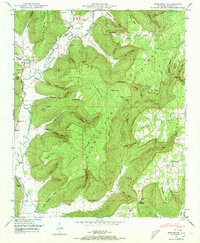
1948 Map of Princeton
USGS Topo · Published 1973About this map
Paint Rock River valley and its surrounding ridges dominate this 1948 landscape, capturing a network of rural settlements and family-named hollows. Centered on Princeton, the map shows the winding paths of Larkin Fork and Lick Fork as they converge, feeding a river system that defined the area's early transport and development. The geography here is a complex arrangement of sharp vertical relief, where farming was often limited to the narrow coves like Thompson Cove and Williams Cove.
Find a feature on this map
83 named features on this map. Tap any name to fly to it.
Don’t see what you’re looking for? This feature index may not catch every label — zoom into the map to look around manually.
Map Details
Editions of this 1948 Princeton Map
3 editions found
Other maps of this area

1888 · Scottsboro
USGS Topo · 1:125,000

1892 · Scottsboro
USGS Topo · 1:125,000

1936 · Scottsboro
USGS Topo · 1:24,000

1936 · King Cove
USGS Topo · 1:24,000

1936 · Hollytree
USGS Topo · 1:24,000

1936 · Mud Creek
USGS Topo · 1:24,000

1936 · Hytop
USGS Topo · 1:24,000

1936 · Princeton
USGS Topo · 1:24,000

1936 · Lim Rock
USGS Topo · 1:24,000
1936 · Paint Rock
USGS Topo · 1:24,000