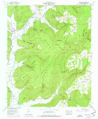
1948 Map of Princeton
USGS Topo · Published 1977About this map
The Paint Rock River valley serves as the central artery for small agricultural settlements in Jackson County during the mid-twentieth century. Communities such as Princeton and Hollytree are positioned along the river's path, where the valley floor provides a level corridor between the steep rising slopes of Jacobs Mountain and the Cumberland Plateau. The landscape is deeply carved by countless hollows and coves, including Graham Cove and Fowler Cove, many of which host family cemeteries like Graham Cem and Fowler Cem. This pattern of settlement reflects a reliance on the narrow fertile strips of bottomland while the higher elevations remained timbered. Upland features such as Sand Bluff and Logan Point overlook a network of rural routes, including LR 56 and LR 58, connecting scattered hamlets like Swaim and Letcher to the river valley system.
Find a feature on this map
83 named features on this map. Tap any name to fly to it.
Don’t see what you’re looking for? This feature index may not catch every label — zoom into the map to look around manually.
Map Details
Editions of this 1948 Princeton Map
3 editions found
Other maps of this area

1888 · Scottsboro
USGS Topo · 1:125,000

1892 · Scottsboro
USGS Topo · 1:125,000

1936 · Scottsboro
USGS Topo · 1:24,000

1936 · King Cove
USGS Topo · 1:24,000

1936 · Hollytree
USGS Topo · 1:24,000

1936 · Mud Creek
USGS Topo · 1:24,000

1936 · Hytop
USGS Topo · 1:24,000

1936 · Princeton
USGS Topo · 1:24,000

1936 · Lim Rock
USGS Topo · 1:24,000
1936 · Paint Rock
USGS Topo · 1:24,000