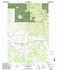
1994 Map of Princeton
USGS Topo · Published 1997About this map
The Palouse River winds through this Idaho landscape during the mid-1990s, serving as a corridor for both the Burlington Northern railroad and the small communities of Princeton and Hampton. The northern half of the map is dominated by the St Joe National Forest, a terrain of steep ridges and deep gulches including Treasure Gulch and Picnic Gulch. This area reflects a history of resource extraction, with mining operations such as the Carrico Mine and the Lost Wheelbarrow Mine located near the headwaters of East Fork Gold Creek.
Find a feature on this map
44 named features on this map. Tap any name to fly to it.
Don’t see what you’re looking for? This feature index may not catch every label — zoom into the map to look around manually.
Map Details
Editions of this 1994 Princeton Map
2 editions found
Other maps of this area

1955 · Pullman
USGS Topo · 1:250,000

1955 · Spokane
USGS Topo · 1:250,000

1957 · Emida
USGS Topo · 1:62,500

1957 · Tensed
USGS Topo · 1:62,500

1958 · Spokane
USGS Topo · 1:250,000

1958 · Pullman
USGS Topo · 1:250,000

1960 · Robinson Lake
USGS Topo · 1:24,000

1960 · Moscow Mtn
USGS Topo · 1:24,000

1960 · Potlatch
USGS Topo · 1:62,500

1961 · Deary
USGS Topo · 1:62,500