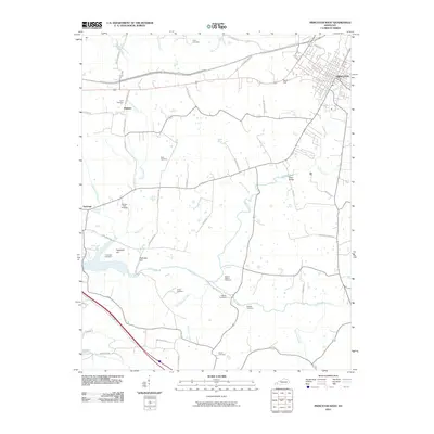
2010 Map of Princeton West
USGS Topo · Published 2010About this map
Eddy Creek meanders through the heart of this Caldwell County landscape, anchoring a rural territory defined by family homesteads and generational burial grounds. West of the growing town of Princeton, the terrain transitions from the rail-oriented South Yard to the agricultural pockets surrounding Dulaney and Saratoga. The map is particularly dense with small family cemeteries, such as the Craig Cemetery, Beck Cemetery, and the Freeman-Cash Cemetery, which serve as vital markers of the area's early settlement patterns. Historical transit is evidenced by the numerous named roads like Old Fredonia Rd and the crossing at Wiley Bridge. The presence of Harpending Springs and Saratoga Spring underscores the importance of natural water sources in shaping the community's development from the nineteenth century into the modern era.
Find a feature on this map
63 named features on this map. Tap any name to fly to it.
Don’t see what you’re looking for? This feature index may not catch every label — zoom into the map to look around manually.
Map Details
Editions of this 2010 Princeton West Map
This is the sole edition of this map. No revisions or reprints were ever made.
Other maps of this area

1908 · Princeton
USGS Topo · 1:62,500

1910 · Princeton
USGS Topo · 1:62,500

1928 · Eddyville
USGS Topo · 1:48,000

1931 · Eddyville
USGS Topo · 1:62,500

1936 · Eddyville
USGS Topo · 1:48,000

1936 · Mont
USGS Topo · 1:24,000

1936 · Golden Pond
USGS Topo · 1:48,000

1949 · Paducah
USGS Topo · 1:250,000

1950 · Paducah
USGS Topo · 1:250,000
1950 · Mont
USGS Topo · 1:24,000