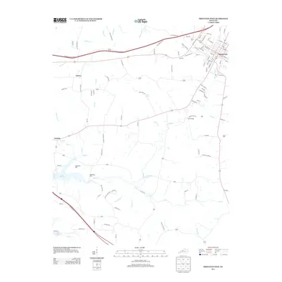
2013 Map of Princeton West
USGS Topo · Published 2013About this map
The western edges of Princeton and the surrounding agricultural landscape of Caldwell County are meticulously documented in this 2013 survey. The terrain is defined by its water sources, including the subterranean-fed Big Spring near the town center and the expansive Lake Barkley along the southwestern boundary. Small rural communities like Dulaney and Saratoga anchor the countryside, where the hydrology of Eddy Cr and its tributaries carve a complex path through the limestone-rich topography. Notable landmarks such as Wiley Bridge and the elevations of Hopewell Hill and Hallaway Hill provide clear reference points for the local geography. The map also highlights significant natural springs, including Saratoga Spring and Harpending Springs, which have historically influenced settlement patterns and land use in this part of Western Kentucky. Modern infrastructure like the Western Kentucky Pkwy and South Yard reflect the area's continued role as a regional transport corridor.
Find a feature on this map
110 named features on this map. Tap any name to fly to it.
Don’t see what you’re looking for? This feature index may not catch every label — zoom into the map to look around manually.
Map Details
Editions of this 2013 Princeton West Map
This is the sole edition of this map. No revisions or reprints were ever made.
Other maps of this area

1908 · Princeton
USGS Topo · 1:62,500

1910 · Princeton
USGS Topo · 1:62,500

1928 · Eddyville
USGS Topo · 1:48,000

1931 · Eddyville
USGS Topo · 1:62,500

1936 · Eddyville
USGS Topo · 1:48,000

1936 · Mont
USGS Topo · 1:24,000

1936 · Golden Pond
USGS Topo · 1:48,000

1949 · Paducah
USGS Topo · 1:250,000

1950 · Paducah
USGS Topo · 1:250,000
1950 · Mont
USGS Topo · 1:24,000