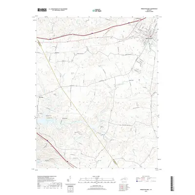
2019 Map of Princeton West
USGS Topo · Published 2019About this map
Lake Barkley and the winding course of Eddy Creek define the western reaches of Caldwell County in this 2019 survey. The area is dense with small family and community burial grounds, including Craig Cem, Scott Cem, and Hopewell Cem, many of which are tucked along rural routes like Groomes Chapel Rd and Silver Star School Rd. The settlement of Princeton sits at the northeastern corner, where the grid of W Main St and N Jefferson St gives way to the open creek bottoms and karst features such as Saratoga Spring.
Find a feature on this map
98 named features on this map. Tap any name to fly to it.
Don’t see what you’re looking for? This feature index may not catch every label — zoom into the map to look around manually.
Map Details
Editions of this 2019 Princeton West Map
This is the sole edition of this map. No revisions or reprints were ever made.
Other maps of this area

1908 · Princeton
USGS Topo · 1:62,500

1910 · Princeton
USGS Topo · 1:62,500

1928 · Eddyville
USGS Topo · 1:48,000

1931 · Eddyville
USGS Topo · 1:62,500

1936 · Eddyville
USGS Topo · 1:48,000

1936 · Mont
USGS Topo · 1:24,000

1936 · Golden Pond
USGS Topo · 1:48,000

1949 · Paducah
USGS Topo · 1:250,000

1950 · Paducah
USGS Topo · 1:250,000
1950 · Mont
USGS Topo · 1:24,000