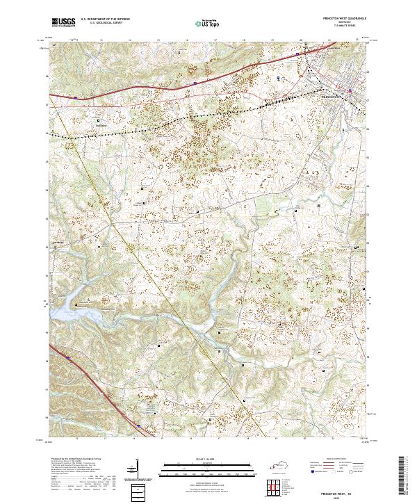
2022 Map of Princeton West
USGS Topo · Published 2022About this map
Princeton serves as the focal point of this western Kentucky landscape, anchored by the Caldwell County Courthouse and the historic Cumberland College Cem. The terrain is defined by the winding course of Eddy Creek and its many tributaries, such as Wallace Br and Dry Creek, which flow toward the broad waters of Lake Barkley in the southwest corner. The map reveals a dense network of family and community landmarks, including numerous small burial grounds like the Robert Gray Cem and Sebron - Kilgore Cem, reflecting generations of settlement near Saratoga and Dulaney. Natural springs, such as Harpending Springs and Hayes Spring, likely served as vital early water sources for these rural communities before the modern road system connected the county seat to outlying ridges like Hopewell Hill.
Find a feature on this map
125 named features on this map. Tap any name to fly to it.
Don’t see what you’re looking for? This feature index may not catch every label — zoom into the map to look around manually.
Map Details
Editions of this 2022 Princeton West Map
This is the sole edition of this map. No revisions or reprints were ever made.
Other maps of this area

1908 · Princeton
USGS Topo · 1:62,500

1910 · Princeton
USGS Topo · 1:62,500

1928 · Eddyville
USGS Topo · 1:48,000

1931 · Eddyville
USGS Topo · 1:62,500

1936 · Eddyville
USGS Topo · 1:48,000

1936 · Mont
USGS Topo · 1:24,000

1936 · Golden Pond
USGS Topo · 1:48,000

1949 · Paducah
USGS Topo · 1:250,000

1950 · Paducah
USGS Topo · 1:250,000
1950 · Mont
USGS Topo · 1:24,000