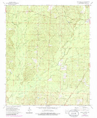
1973 Map of Princeton West
USGS Topo · Published 1986About this map
Princeton and the nearby settlement of Jacinto anchor this Arkansas landscape during the early 1970s. The terrain is defined by an intricate network of slow-moving waterways and low-lying areas, including Hickory Flats and Alsobrook Slough. The rural character of Dallas County is evident in the distribution of family-named landmarks and local institutions, such as Henderson Cemetery and Mt Zion Church.
Find a feature on this map
34 named features on this map. Tap any name to fly to it.
Don’t see what you’re looking for? This feature index may not catch every label — zoom into the map to look around manually.
Map Details
Editions of this 1973 Princeton West Map
2 editions found
Other maps of this area

1903 · Camden
USGS Topo · 1:125,000

1953 · El Dorado
USGS Topo · 1:250,000

1955 · Little Rock
USGS Topo · 1:250,000

1956 · Little Rock
USGS Topo · 1:250,000

1957 · El Dorado
USGS Topo · 1:250,000

1958 · El Dorado
USGS Topo · 1:250,000

1960 · El Dorado
USGS Topo · 1:250,000

1960 · Little Rock
USGS Topo · 1:250,000

1964 · Little Rock
USGS Topo · 1:250,000
1965 · Manning
USGS Topo · 1:24,000