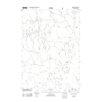
2012 Map of Pringle
USGS Topo · Published 2012About this map
Beaver Valley serves as a primary geographic anchor for this part of Custer County, where the landscape is defined by its deep canyons and prominent ridges. The area's ranching heritage is clearly documented through numerous family-named holdings, such as Bowman Ranch, Taylor Ranch, and Gillis Ranch, which are distributed along the drainages of Beaver Cr and Cold Spring Cr. Transportation routes like Co HWY 315 and Argyle Rd provide access to more remote points, including the heights of the Twin Sisters Range and the Elk Knob peak. For local history, the map preserves the location of the Pringle Cem and the recreational development at Rifle Pit Campground. Numerous natural water sources, including Witch Spring and Woodcock Spring, indicate the vital locations for water in this high-plains environment.
Find a feature on this map
52 named features on this map. Tap any name to fly to it.
Don’t see what you’re looking for? This feature index may not catch every label — zoom into the map to look around manually.
Map Details
Editions of this 2012 Pringle Map
This is the sole edition of this map. No revisions or reprints were ever made.
Other maps of this area

1894 · Hermosa
USGS Topo · 1:125,000

1896 · Oelrichs
USGS Topo · 1:125,000

1896 · Harney Peak
USGS Topo · 1:125,000

1900 · Oelrichs
USGS Topo · 1:125,000

1901 · Hermosa
USGS Topo · 1:125,000

1901 · Harney Peak
USGS Topo · 1:125,000

1902 · Edgemont
USGS Topo · 1:125,000

1950 · Hot Springs
USGS Topo · 1:24,000

1950 · Minnekahta
USGS Topo · 1:24,000

1951 · Minnekahta NE
USGS Topo · 1:24,000