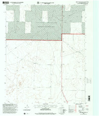
1998 Map of Pritchard Ranch
USGS Topo · Published 2001About this map
Rita Blanca National Grassland dominates the northern landscape of this Dallam County region, reflecting the conservation-led land management of the late 20th century. The terrain is defined by the ephemeral passage of Red Cow Draw and the scattered presence of human activity in an otherwise open range. Evidence of ranching and early industrial exploration is visible through the Pritchard Ranch settlement and various utilitarian features such as a Well, a Drill Hole, and multiple Gravel Pit sites. A prominent Pipeline cuts across the survey area, marking the infrastructure necessary to move resources through the High Plains. This 1998 revision, based on earlier 1971 topography, provides a precise record of water management and land use in a corner of the Texas Panhandle focused on grazing and extractive resources.
Find a feature on this map
7 named features on this map. Tap any name to fly to it.
Don’t see what you’re looking for? This feature index may not catch every label — zoom into the map to look around manually.
Map Details
Editions of this 1998 Pritchard Ranch Map
This is the sole edition of this map. No revisions or reprints were ever made.
Other maps of this area

1954 · Dalhart
USGS Topo · 1:250,000

1958 · Dalhart
USGS Topo · 1:250,000

1962 · Dalhart
USGS Topo · 1:250,000

1973 · Stratford 2 NW
USGS Topo · 1:24,000

1973 · Tovrea Ranch
USGS Topo · 1:24,000

1973 · Bolin NE
USGS Topo · 1:24,000

1973 · Bolin
USGS Topo · 1:24,000
1973 · Coldwater West
USGS Topo · 1:24,000

1973 · Coldwater East
USGS Topo · 1:24,000
1973 · Pritchard Ranch
USGS Topo · 1:24,000