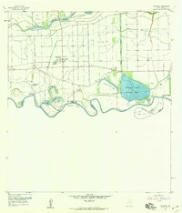
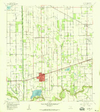
1956 Map of Progreso
USGS Topo · Published 1959About this map
The Rio Grande meanders along the southern edge of this mid-century survey, defining the international boundary and the intricate hydrology of the Rio Grande Valley. Irrigation and flood control dominate the landscape, visible through the Main Floodway, Llano Grande North Floodway, and the massive Mercedes District Settling Basin. The settlement of Progreso serves as a local hub near the Progreso Bend, where a U.S. Customs & Immigration station marks the crossing point.
Find a feature on this map
37 named features on this map. Tap any name to fly to it.
Don’t see what you’re looking for? This feature index may not catch every label — zoom into the map to look around manually.
Map Details
Editions of this 1956 Progreso Map
4 editions found
Other maps of this area

1914 · San Juan
USGS Topo · 1:48,000

1916 · San Juan
USGS Topo · 1:62,500

1929 · Santa Maria
USGS Topo · 1:24,000

1929 · La Feria
USGS Topo · 1:24,000

1936 · La Feria
USGS Topo · 1:31,680

1936 · Santa Maria
USGS Topo · 1:31,680

1949 · Mc Allen
USGS Topo · 1:250,000

1953 · Brownsville
USGS Topo · 1:250,000

1954 · McAllen
USGS Topo · 1:250,000
1956 · La Feria
USGS Topo · 1:24,000