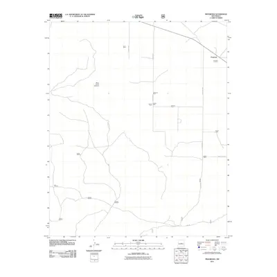
2011 Map of Progresso
USGS Topo · Published 2011About this map
Progresso and its surrounding ranchlands occupy the high plains of Torrance County, where the topography is defined by the massive Mesa de los Jumanos. This early 21st-century landscape is characterized by its reliance on traditional water sources and isolated ranching operations. The network of county roads, including County Rd-90 and County Rd-89, connects several established family holdings such as the Hansen Ranch, Osborne Ranch, and the DeVaney Ranch.
Find a feature on this map
27 named features on this map. Tap any name to fly to it.
Don’t see what you’re looking for? This feature index may not catch every label — zoom into the map to look around manually.
Map Details
Editions of this 2011 Progresso Map
This is the sole edition of this map. No revisions or reprints were ever made.
Other maps of this area

1917 · Estancia
USGS Topo · 1:125,000

1954 · Fort Sumner
USGS Topo · 1:250,000

1954 · Socorro
USGS Topo · 1:250,000

1956 · Mountainair
USGS Topo · 1:62,500

1958 · Socorro
USGS Topo · 1:250,000

1958 · Fort Sumner
USGS Topo · 1:250,000

1962 · Socorro
USGS Topo · 1:250,000

1972 · Gran Quivira
USGS Topo · 1:24,000
1972 · Round Top
USGS Topo · 1:24,000

1978 · Laguna Del Perro South
USGS Topo · 1:24,000