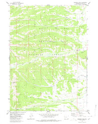
1980 Map of Prospect Peak
USGS Topo · Published 1980About this map
Prospect Peak rises above a landscape defined by high ridges and a dense network of watercourses within the Bridger National Forest. The map documents a significant network of historic routes, including the Old Indian Trail and various other pack trails that navigate the steep topography of Beaver Ridge. These trails provide a clear record of early movement through the region, connecting the drainages of South Beaver Creek in the north to North Horse Creek and South Horse Creek in the south.
Find a feature on this map
23 named features on this map. Tap any name to fly to it.
Don’t see what you’re looking for? This feature index may not catch every label — zoom into the map to look around manually.
Map Details
Editions of this 1980 Prospect Peak Map
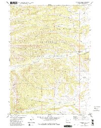
2 editions found
Other maps of this area

1907 · Gros Ventre
USGS Topo · 1:125,000

1910 · Gros Ventre
USGS Topo · 1:125,000

1921 · Afton
USGS Topo · 1:125,000

1931 · Jackson
USGS Topo · 1:125,000

1935 · Jackson
USGS Topo · 1:125,000

1939 · Big Piney
USGS Topo · 1:125,000

1942 · Big Piney
USGS Topo · 1:125,000

1955 · Driggs
USGS Topo · 1:250,000

1955 · Preston
USGS Topo · 1:250,000

1958 · Driggs
USGS Topo · 1:250,000