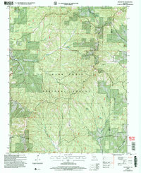
2004 Map of Protem NE
USGS Topo · Published 2006About this map
Fairview Church and the nearby Fairview settlement anchor the southwestern corner of this landscape, which is heavily defined by the protected acreage of the Mark Twain National Forest. The terrain is characterized by a series of prominent ridges, such as Pelham Ridge and Clayton Ridge, separated by deep hollows like Bray Hollow and Buttram Hollow. A significant portion of the area is occupied by the Hercules Wilderness, where few modern structures exist.
Find a feature on this map
34 named features on this map. Tap any name to fly to it.
Don’t see what you’re looking for? This feature index may not catch every label — zoom into the map to look around manually.
Map Details
Editions of this 2004 Protem NE Map
This is the sole edition of this map. No revisions or reprints were ever made.
Other maps of this area

1936 · Thornfield
USGS Topo · 1:48,000

1936 · Ava
USGS Topo · 1:48,000

1937 · Bradleyville
USGS Topo · 1:48,000

1942 · Ava
USGS Topo · 1:62,500

1943 · Protem
USGS Topo · 1:62,500

1943 · Thornfield
USGS Topo · 1:62,500

1943 · Bradleyville
USGS Topo · 1:62,500

1945 · Ava
USGS Topo · 1:62,500

1945 · Harrison
USGS Topo · 1:250,000

1945 · Thornfield
USGS Topo · 1:62,500