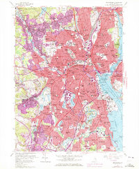
1957 Map of Providence
USGS Topo · Published 1972About this map
The Providence metropolitan core is documented here at a mid-century peak of urban density, showing the complex industrial and residential landscape of the state capital. The Woonasquatucket River and Moshassuck River converge near the State Capitol, while the Seekonk River and Providence River define the eastern maritime edge. The waterfront is an intricate network of commerce, featuring State Pier 34, Wilkes Barre Pier, and the Harbor Junc Wharf.
Find a feature on this map
231 named features on this map. Tap any name to fly to it.
Don’t see what you’re looking for? This feature index may not catch every label — zoom into the map to look around manually.
Map Details
Editions of this 1957 Providence Map
4 editions found
Other maps of this area

1887 · Providence
USGS Topo · 1:62,500

1889 · Providence
USGS Topo · 1:62,500

1889 · Burrillville
USGS Topo · 1:62,500

1890 · Narragansett Bay
USGS Topo · 1:62,500

1890 · Kent
USGS Topo · 1:62,500

1892 · Narragansett Bay
USGS Topo · 1:62,500

1894 · Burrillville
USGS Topo · 1:62,500

1894 · Kent
USGS Topo · 1:62,500

1894 · Providence
USGS Topo · 1:62,500

1915 · Burrillville
USGS Topo · 1:62,500