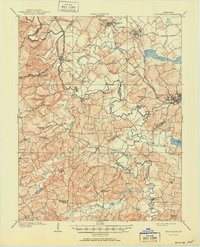
1909 Map of Providence
USGS Topo · Published 1951About this map
The Tradewater River winds through a landscape of tight ridges and sprawling creek bottoms at the dawn of the twentieth century, marking the boundaries between Union, Webster, Crittenden, Caldwell, and Hopkins counties. This territory is anchored by the coal and rail hubs of Providence, Wheatcroft, and Clay, where the Illinois Central and the Kentucky Valley RR facilitated the region's industrial growth.
Find a feature on this map
92 named features on this map. Tap any name to fly to it.
Don’t see what you’re looking for? This feature index may not catch every label — zoom into the map to look around manually.
Map Details
Editions of this 1909 Providence Map
3 editions found
Other maps of this area

1906 · Sebree
USGS Topo · 1:62,500

1907 · Earlington
USGS Topo · 1:48,000

1907 · Morganfield
USGS Topo · 1:62,500

1908 · Princeton
USGS Topo · 1:62,500

1909 · Dawson Springs
USGS Topo · 1:48,000

1909 · Earlington
USGS Topo · 1:62,500

1909 · Providence
USGS Topo · 1:62,500

1910 · Princeton
USGS Topo · 1:62,500

1911 · Dawson Springs
USGS Topo · 1:62,500

1916 · Shawneetown
USGS Topo · 1:62,500