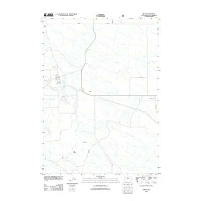
2012 Map of Provo
USGS Topo · Published 2012About this map
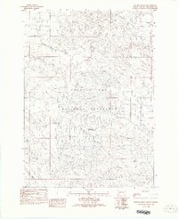
Igloo and Provo anchor this section of Fall River County, reflecting the sparse settlement patterns of southwestern South Dakota. This landscape is defined by its drainages, where Coal Cr and Softwater Cr flow through a region historically shaped by rural ranching and military-industrial proximity. The presence of Trotter Ranch and Henderson Ranch highlights the enduring footprint of family operations in this semi-arid environment. Further south, the terrain opens into Hay Draw, a distinctive topographical depression that guides the local seasonal hydrology. The map captures a transition point in the 21st century where established ranching boundaries meet the legacy of earlier 20th-century developments, providing a clear look at the road networks like Co HWY-3292 that connect these remote outposts.
Find a feature on this map
12 named features on this map. Tap any name to fly to it.
Don’t see what you’re looking for? This feature index may not catch every label — zoom into the map to look around manually.
Map Details
Editions of this 2012 Provo Map
This is the sole edition of this map. No revisions or reprints were ever made.
Other maps of this area

1902 · Edgemont
USGS Topo · 1:125,000

1950 · Edgemont
USGS Topo · 1:24,000

1950 · Edgemont SW
USGS Topo · 1:24,000

1950 · Rumford
USGS Topo · 1:24,000

1950 · Flint Hill
USGS Topo · 1:24,000

1955 · Hot Springs
USGS Topo · 1:250,000
1982 · Crowe Dam
USGS Topo · 1:25,000
1982 · Provo
USGS Topo · 1:25,000
1982 · Ardmore
USGS Topo · 1:25,000
1982 · Phister Ranch
USGS Topo · 1:25,000