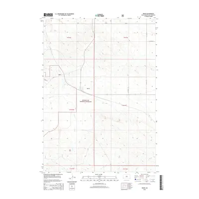
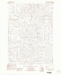
2015 Map of Provo
USGS Topo · Published 2015About this map
Buffalo Gap National Grassland dominates this South Dakota landscape, where the prairie of Fall River County is defined by a sparse network of roads and intermittent watercourses. The settlement of Provo sits at a junction of local routes, while to the northwest, the distinct footprint of Igloo remains a visible marker of mid-century activity. This region’s geography is shaped by the drainage patterns of Coal Cr, Softwater Cr, and Cow Cr, which carve through the terrain to the south and east. The map illustrates a transitional space between agricultural grazing land and managed federal grassland. Notable landmarks like Hay Draw and the long stretches of Plum Creek Rd and Plains Creek Rd highlight the isolated nature of these plains, where the grid of the Public Land Survey System provides the primary structural framework for land management and travel.
Find a feature on this map
21 named features on this map. Tap any name to fly to it.
Don’t see what you’re looking for? This feature index may not catch every label — zoom into the map to look around manually.
Map Details
Editions of this 2015 Provo Map
This is the sole edition of this map. No revisions or reprints were ever made.
Other maps of this area

1902 · Edgemont
USGS Topo · 1:125,000

1950 · Edgemont
USGS Topo · 1:24,000

1950 · Edgemont SW
USGS Topo · 1:24,000

1950 · Rumford
USGS Topo · 1:24,000

1950 · Flint Hill
USGS Topo · 1:24,000

1955 · Hot Springs
USGS Topo · 1:250,000
1982 · Crowe Dam
USGS Topo · 1:25,000
1982 · Provo
USGS Topo · 1:25,000
1982 · Ardmore
USGS Topo · 1:25,000
1982 · Phister Ranch
USGS Topo · 1:25,000