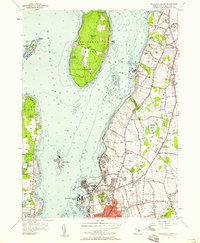
1955 Map of Prudence Island
USGS Topo · Published 1958About this map
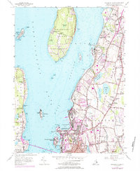
Prudence Island sits at the heart of this mid-century survey, flanked by the sprawling naval infrastructure of Rhode Island and the smaller outcrops of Hope Island and Gould Island. The map documents a transitional period in the Newport area, where traditional island settlements like Homestead and Prudence coexist with significant military installations. The U S Naval Reservation at Coddington Cove and Coasters Harbor Island dominates the shoreline north of Newport, illustrating the intense strategic utility of Narragansett Bay during the Cold War.
Find a feature on this map
105 named features on this map. Tap any name to fly to it.
Don’t see what you’re looking for? This feature index may not catch every label — zoom into the map to look around manually.
Map Details
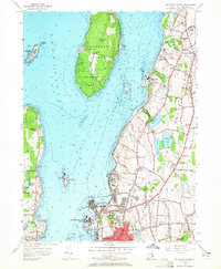
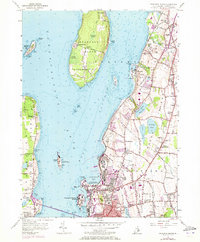
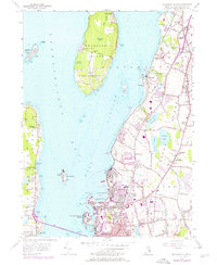
Editions of this 1955 Prudence Island Map
5 editions found
Other maps of this area

1885 · Sakonnet
USGS Topo · 1:62,500

1888 · Fall River
USGS Topo · 1:62,500

1888 · Sakonnet
USGS Topo · 1:62,500

1889 · Newport
USGS Topo · 1:62,500

1890 · Narragansett Bay
USGS Topo · 1:62,500

1892 · Narragansett Bay
USGS Topo · 1:62,500

1893 · Sakonnet
USGS Topo · 1:62,500

1893 · Fall River
USGS Topo · 1:62,500

1894 · Newport
USGS Topo · 1:62,500

1904 · Newport
USGS Topo · 1:62,500