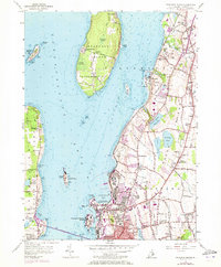
1955 Map of Prudence Island
USGS Topo · Published 1973About this map
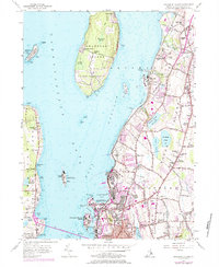
Prudence Island and the northern reaches of Conanicut Island sit at the center of this Narragansett Bay study, which details the shoreline and interior of Middletown, Portsmouth, and Newport. The landscape is a mix of agricultural plots, residential expansion, and significant military infrastructure. Massive U.S. Naval Reservations dominate the coastal margins of Aquidneck Island, reflecting the era's heavy defense presence around Coddington Cove and Melville.
Find a feature on this map
126 named features on this map. Tap any name to fly to it.
Don’t see what you’re looking for? This feature index may not catch every label — zoom into the map to look around manually.
Map Details
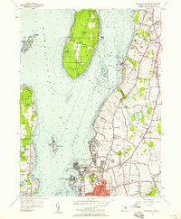
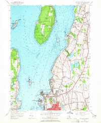
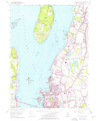
Editions of this 1955 Prudence Island Map
5 editions found
Other maps of this area

1885 · Sakonnet
USGS Topo · 1:62,500

1888 · Fall River
USGS Topo · 1:62,500

1888 · Sakonnet
USGS Topo · 1:62,500

1889 · Newport
USGS Topo · 1:62,500

1890 · Narragansett Bay
USGS Topo · 1:62,500

1892 · Narragansett Bay
USGS Topo · 1:62,500

1893 · Sakonnet
USGS Topo · 1:62,500

1893 · Fall River
USGS Topo · 1:62,500

1894 · Newport
USGS Topo · 1:62,500

1904 · Newport
USGS Topo · 1:62,500