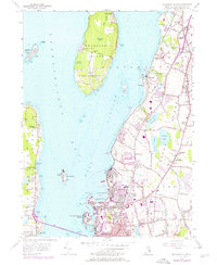
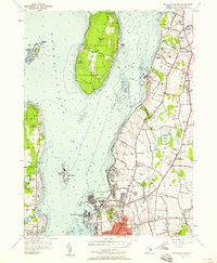
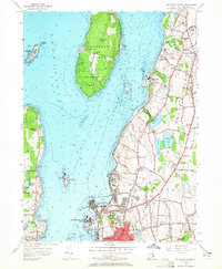
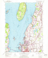
1955 Map of Prudence Island
USGS Topo · Published 1976About this map
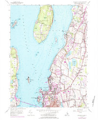
Prudence Island and Conanicut Island anchor this coastal survey, which reveals a landscape defined by strategic maritime activity and established residential hamlets in the mid-1950s. The heavy footprint of the U S Naval Reservation spans both Prudence and the mainland near Melville, reflecting the region's critical military importance. Further south, the urban core of Newport meets the suburban expansion of Middletown, where local community life is marked by the Middletown Cem, Berkeley Sch, and the Drive-in theater.
Find a feature on this map
101 named features on this map. Tap any name to fly to it.
Don’t see what you’re looking for? This feature index may not catch every label — zoom into the map to look around manually.
Map Details
Editions of this 1955 Prudence Island Map
5 editions found
Other maps of this area

1885 · Sakonnet
USGS Topo · 1:62,500

1888 · Fall River
USGS Topo · 1:62,500

1888 · Sakonnet
USGS Topo · 1:62,500

1889 · Newport
USGS Topo · 1:62,500

1890 · Narragansett Bay
USGS Topo · 1:62,500

1892 · Narragansett Bay
USGS Topo · 1:62,500

1893 · Sakonnet
USGS Topo · 1:62,500

1893 · Fall River
USGS Topo · 1:62,500

1894 · Newport
USGS Topo · 1:62,500

1904 · Newport
USGS Topo · 1:62,500