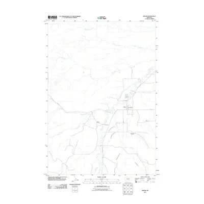
2011 Map of Pryor
USGS Topo · Published 2011About this map
Pryor serves as the central hub of this Crow Reservation landscape, situated where the high plains meet the intricate drainage systems of the Pryor Mountains foothills. The settlement pattern is anchored by the Pryor Post Office and connected by arterial routes like Pryor Rd and Mission Rd. A significant irrigation network, vital for local agriculture, is etched across the terrain through the Pryor Ditch Number One, Pryor Ditch Number Two, and Pryor Ditch Number Three, alongside the Lost Creek Ditch.
Find a feature on this map
19 named features on this map. Tap any name to fly to it.
Don’t see what you’re looking for? This feature index may not catch every label — zoom into the map to look around manually.
Map Details
Editions of this 2011 Pryor Map
This is the sole edition of this map. No revisions or reprints were ever made.
Other maps of this area

1893 · Huntley
USGS Topo · 1:125,000

1954 · Billings
USGS Topo · 1:250,000

1957 · Billings
USGS Topo · 1:250,000

1958 · Billings
USGS Topo · 1:250,000

1967 · Castle Rocks
USGS Topo · 1:24,000

1967 · Deep Creek
USGS Topo · 1:24,000

1967 · Pryor
USGS Topo · 1:24,000

1967 · Deep Creek SW
USGS Topo · 1:24,000

1967 · Section House Draw
USGS Topo · 1:24,000
1967 · Mossmain SW
USGS Topo · 1:24,000