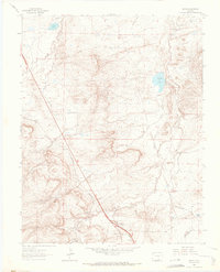
1963 Map of Pryor
USGS Topo · Published 1966About this map
Industrial coal heritage and early twentieth-century settlement patterns define this landscape on the border of Huerfano and Las Animas counties. Mining operations are central to the terrain, marked by Hezron Mines and numerous Mine Dumps scattered near the Hezron Camp (Ruins). The Colorado and Southern Railroad cuts a diagonal path through the area, linking the small communities of Pryor, Lester, and Monsoni.
Find a feature on this map
28 named features on this map. Tap any name to fly to it.
Don’t see what you’re looking for? This feature index may not catch every label — zoom into the map to look around manually.
Map Details
Editions of this 1963 Pryor Map
3 editions found
Other maps of this area

1891 · Walsenburg
USGS Topo · 1:125,000

1891 · Spanish Peaks
USGS Topo · 1:125,000

1893 · Spanish Peaks
USGS Topo · 1:125,000

1894 · Walsenburg
USGS Topo · 1:125,000

1895 · Spanish Peaks
USGS Topo · 1:125,000

1897 · Walsenburg
USGS Topo · 1:125,000

1897 · Spanish Peaks
USGS Topo · 1:125,000

1900 · Spanish Peaks
USGS Topo · 1:125,000

1900 · Walsenburg
USGS Topo · 1:125,000

1954 · Trinidad
USGS Topo · 1:250,000