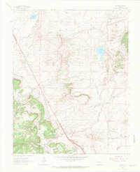
1963 Map of Pryor
USGS Topo · Published 1966About this map
Pryor and the remnants of industrial life define this high-plains landscape along the Huerfano and Las Animas county line. By the mid-1960s, the region’s coal mining history remains visible through the Hezron Mines and extensive Mine Dumps scattered across the terrain. The settlement of Hezron Camp (Ruins) and the small community at Lester are connected by the Colorado and Southern Railroad, which winds through the area alongside older transportation routes like the Old Railroad Grade.
Find a feature on this map
27 named features on this map. Tap any name to fly to it.
Don’t see what you’re looking for? This feature index may not catch every label — zoom into the map to look around manually.
Map Details
Editions of this 1963 Pryor Map
3 editions found
Other maps of this area

1891 · Walsenburg
USGS Topo · 1:125,000

1891 · Spanish Peaks
USGS Topo · 1:125,000

1893 · Spanish Peaks
USGS Topo · 1:125,000

1894 · Walsenburg
USGS Topo · 1:125,000

1895 · Spanish Peaks
USGS Topo · 1:125,000

1897 · Walsenburg
USGS Topo · 1:125,000

1897 · Spanish Peaks
USGS Topo · 1:125,000

1900 · Spanish Peaks
USGS Topo · 1:125,000

1900 · Walsenburg
USGS Topo · 1:125,000

1954 · Trinidad
USGS Topo · 1:250,000