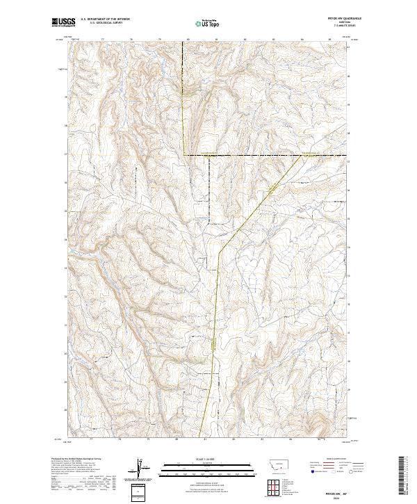
2024 Map of Pryor NW
USGS Topo · Published 2024About this map
The convergence of three Montana counties—Carbon, Yellowstone, and Big Horn—defines the administrative layout of this high-elevation landscape. The terrain is deeply carved by a network of seasonal and perennial watercourses, including the westward-flowing Wolf Creek and the headwaters of North Fork Fivemile Creek and Middle Fork Fivemile Creek. These drainages dictate the modern infrastructure of the region, where rural transport corridors like Pryor Rd and E Pryor Rd follow the natural contours of the ridges and valleys. While largely unsettled, the map details the complex system of public land surveys with Township and Range divisions such as t4s r24e and t5s r25e, which serve as the primary framework for land ownership and cattle ranching in this part of the Crow Indian Reservation vicinity.
Find a feature on this map
17 named features on this map. Tap any name to fly to it.
Don’t see what you’re looking for? This feature index may not catch every label — zoom into the map to look around manually.
Map Details
Editions of this 2024 Pryor NW Map
This is the sole edition of this map. No revisions or reprints were ever made.
Other maps of this area

1954 · Billings
USGS Topo · 1:250,000

1956 · Silesia
USGS Topo · 1:24,000

1956 · Edgar
USGS Topo · 1:24,000

1957 · Billings
USGS Topo · 1:250,000

1958 · Billings
USGS Topo · 1:250,000

1967 · Castle Rocks
USGS Topo · 1:24,000

1967 · Pryor
USGS Topo · 1:24,000

1967 · Section House Draw
USGS Topo · 1:24,000

1967 · Bluewater
USGS Topo · 1:24,000
1967 · Mossmain SW
USGS Topo · 1:24,000