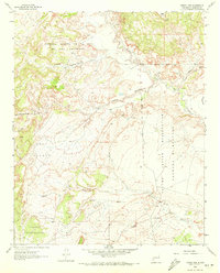
1961 Map of Puerco Dam
USGS Topo · Published 1972About this map
The Rio Puerco drainage system dominates this high-desert landscape of Sandoval County, where the transition from flat mesa tops to deep arroyo carving is evident. Significant land grants and tribal territories define the human geography, notably the Laguna Indian Reservation Montaño Bernabe and the Nuestra Señora de la Luz de las Lagunitas. These boundaries cut across a terrain shaped by seasonal waterflow, where features like Salado Creek and Arroyo Cuervo provide the primary geographical markers.
Find a feature on this map
21 named features on this map. Tap any name to fly to it.
Don’t see what you’re looking for? This feature index may not catch every label — zoom into the map to look around manually.
Map Details
Editions of this 1961 Puerco Dam Map
2 editions found
Other maps of this area

1883 · Mt. Taylor
USGS Topo · 1:250,000

1886 · Mt. Taylor
USGS Topo · 1:250,000

1888 · Bernalillo
USGS Topo · 1:125,000

1889 · Albuquerque
USGS Topo · 1:125,000

1892 · Mt. Taylor
USGS Topo · 1:250,000

1893 · Albuquerque
USGS Topo · 1:125,000

1899 · Mt. Taylor
USGS Topo · 1:250,000

1954 · Herrera
USGS Topo · 1:24,000

1954 · Sky Village
USGS Topo · 1:24,000
1954 · Benavidez Ranch
USGS Topo · 1:24,000