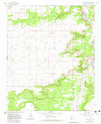
1963 Map of Puerto Creek
USGS Topo · Published 1983About this map
Pecos River valley life in Guadalupe County centers on the settlement of Puerto de Luna, where traditional irrigation and agriculture define the landscape. This 1963 survey, updated with 1979 aerial data, shows a network of water management features including a prominent Ditch system and seasonal drainage from Agua Negra. The community infrastructure is well-documented for local historians, featuring the Puerto de Luna Sch and Calvary Cem.
Find a feature on this map
11 named features on this map. Tap any name to fly to it.
Don’t see what you’re looking for? This feature index may not catch every label — zoom into the map to look around manually.
Map Details
Editions of this 1963 Puerto Creek Map
2 editions found
Other maps of this area

1954 · Fort Sumner
USGS Topo · 1:250,000

1958 · Fort Sumner
USGS Topo · 1:250,000

1963 · Santa Rosa
USGS Topo · 1:24,000

1963 · Puerto Creek
USGS Topo · 1:24,000

1963 · Sunshine Mesa
USGS Topo · 1:24,000

1963 · Puerto De Luna
USGS Topo · 1:24,000

1966 · Ojo Negro Creek
USGS Topo · 1:24,000

1966 · Borica
USGS Topo · 1:24,000
1978 · Pastura NE
USGS Topo · 1:24,000

1978 · Laguna De Los Terreros
USGS Topo · 1:24,000