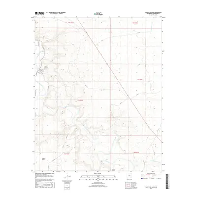
2017 Map of Puerto De Luna
USGS Topo · Published 2017About this map
The Pecos River carves a winding path through this corner of Guadalupe County, defining the agricultural and settlement patterns of the high desert landscape. The village of Puerto De Luna sits at a natural bend in the river, anchored by local history at the Nuestra Senora de Refugio Cem. This area reflects a long-standing ranching and farming tradition, evidenced by the network of named rural routes like Alamo Farm Rd and Mustang Rd that follow the contours of the valley floor.
Find a feature on this map
23 named features on this map. Tap any name to fly to it.
Don’t see what you’re looking for? This feature index may not catch every label — zoom into the map to look around manually.
Map Details
Editions of this 2017 Puerto De Luna Map
This is the sole edition of this map. No revisions or reprints were ever made.
Other maps of this area

1954 · Fort Sumner
USGS Topo · 1:250,000

1958 · Fort Sumner
USGS Topo · 1:250,000

1963 · Santa Rosa
USGS Topo · 1:24,000

1963 · Puerto Creek
USGS Topo · 1:24,000

1963 · Sunshine Mesa
USGS Topo · 1:24,000

1963 · Puerto De Luna
USGS Topo · 1:24,000

1964 · Fallon Ranch
USGS Topo · 1:24,000
1964 · Harben Lake
USGS Topo · 1:24,000

1966 · Gibbons Ranch
USGS Topo · 1:24,000

1966 · Ojo Negro Creek
USGS Topo · 1:24,000