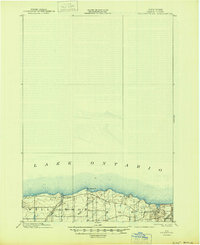
1902 Map of Pultneyville
USGS Topo · Published 1945About this map
Pultneyville sits prominently along the southern shore of Lake Ontario, serving as a focal point for this survey conducted at the close of the 19th century. The landscape is characterized by its proximity to the lake, with coastal features such as Fairbanks Pt. and drainage provided by Salmon Creek and Mink Creek. The survey captures a moment of transition in Wayne County transportation, showing the route of the Electric R. R. cutting through the southern portion of the map. This interurban rail presence highlights the growing connectivity between coastal settlements and inland markets during this era. Divided between the townships of Williamson and Sodus, the map documents the rural road networks and scattered farmsteads that defined this fruit-growing region before modern suburban expansion transformed the shoreline.
Find a feature on this map
9 named features on this map. Tap any name to fly to it.
Don’t see what you’re looking for? This feature index may not catch every label — zoom into the map to look around manually.
Map Details
Editions of this 1902 Pultneyville Map
5 editions found
Other maps of this area

1899 · Palmyra
USGS Topo · 1:62,500

1900 · Macedon
USGS Topo · 1:62,500

1902 · Sodus Bay
USGS Topo · 1:62,500

1902 · Pultneyville
USGS Topo · 1:62,500

1902 · Clyde
USGS Topo · 1:62,500

1902 · Palmyra
USGS Topo · 1:62,500

1942 · Ontario
USGS Topo · 1:31,680

1942 · Pultneyville
USGS Topo · 1:31,680

1943 · Williamson
USGS Topo · 1:31,680

1943 · Sodus Point
USGS Topo · 1:31,680