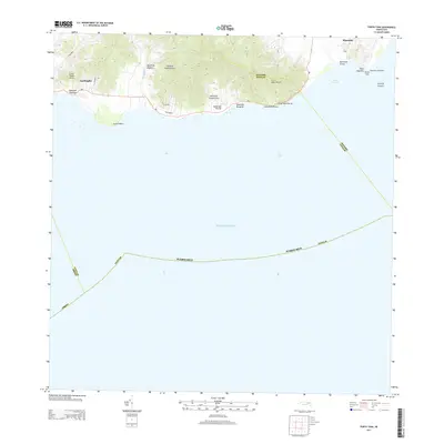
2013 Map of Punta Tuna
USGS Topo · Published 2013About this map
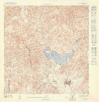
The Maynabo Lighthouse stands as a sentinel at Punta Tuna on the southeastern coast of the Island of Puerto Rico, where the land meets the vast Atlantic Ocean. This maritime landscape is defined by its series of small coastal settlements, including Lamboglia and Maunabo, and the dramatic rise of the terrain toward Cerro Mala Pascua. The coastline is carved by numerous seasonal streams such as Quebrada Higuera, Quebrada Palenque, and Quebrada Florida, which drain the heights of Cerro Piedra Hueca toward the sea.
Find a feature on this map
31 named features on this map. Tap any name to fly to it.
Don’t see what you’re looking for? This feature index may not catch every label — zoom into the map to look around manually.
Map Details
Editions of this 2013 Punta Tuna Map
This is the sole edition of this map. No revisions or reprints were ever made.
Other maps of this area

1945 · Punta Tuna
USGS Topo · 1:30,000

1946 · Patillas
USGS Topo · 1:30,000

1946 · Punta Guayanes
USGS Topo · 1:30,000

1946 · Yabucoa
USGS Topo · 1:30,000

1946 · Guayama
USGS Topo · 1:30,000

1947 · Yabucoa SO
USGS Topo · 1:10,000
1947 · Guayama NE
USGS Topo · 1:10,000
1947 · Punta Tuna NO
USGS Topo · 1:10,000
1947 · Yabucoa SE
USGS Topo · 1:10,000
1947 · Patillas SE
USGS Topo · 1:10,000
Featured Places
- Sector Higuero, Patillas
- Sector Bordaleza, Maunabo
- Sector María Marisca, Patillas
- Barro Blanco, Patillas
- Ríos, Patillas