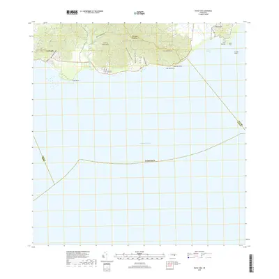
2018 Map of Punta Tuna
USGS Topo · Published 2018About this map
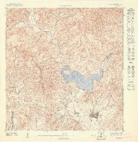
The Sierra de Guardarraya dominates the coastal topography of this southeastern Puerto Rican landscape, forming a dramatic backdrop for the settlements of Maunabo and Lamboglia. The terrain transitions sharply from these high ridges down to the Caribbean Sea, where numerous drainage systems such as Quebrada Higuero and Quebrada Campo Libre reach the shore. The coastal margin is marked by distinctive points and beaches, including Punta Tuna and Playa Maunabo, which define the region's interaction with the sea. Near the shoreline, the Cementerio Guardarraya and a network of local roads like Carr 3 and PR 7758 reflect the established community life and infrastructure connecting these coastal valleys. The map provides a precise look at the land-to-sea boundary, including the maritime hazards of Arrecife Sargent and the sheltered waters of Puerto Maunabo.
Find a feature on this map
39 named features on this map. Tap any name to fly to it.
Don’t see what you’re looking for? This feature index may not catch every label — zoom into the map to look around manually.
Map Details
Editions of this 2018 Punta Tuna Map
This is the sole edition of this map. No revisions or reprints were ever made.
Other maps of this area

1945 · Punta Tuna
USGS Topo · 1:30,000

1946 · Patillas
USGS Topo · 1:30,000

1946 · Punta Guayanes
USGS Topo · 1:30,000

1946 · Yabucoa
USGS Topo · 1:30,000

1946 · Guayama
USGS Topo · 1:30,000

1947 · Yabucoa SO
USGS Topo · 1:10,000
1947 · Guayama NE
USGS Topo · 1:10,000
1947 · Punta Tuna NO
USGS Topo · 1:10,000
1947 · Yabucoa SE
USGS Topo · 1:10,000
1947 · Patillas SE
USGS Topo · 1:10,000
Featured Places
- Sector Higuero, Patillas
- Sector Bordaleza, Maunabo
- Sector María Marisca, Patillas
- Barro Blanco, Patillas
- Ríos, Patillas