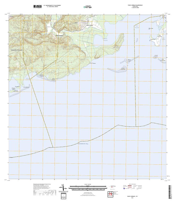
2024 Map of Punta Verraco
USGS Topo · Published 2024About this map
Barrio Indios and the surrounding coastal landscape of southwest Puerto Rico are documented here, showing the complex interface between the southern hills and the Caribbean Sea. The terrain is marked by prominent elevations like La Covana and Cerro Toro, which overlook a deeply indented coastline featuring the Puerto de Guayanilla and Bahía Guayanilla. This modern survey details the geographic relationship between the inland settlements of La Joya, Indios, and Media Quijada and the protected waters of the bay.
Find a feature on this map
35 named features on this map. Tap any name to fly to it.
Don’t see what you’re looking for? This feature index may not catch every label — zoom into the map to look around manually.
Map Details
Editions of this 2024 Punta Verraco Map
This is the sole edition of this map. No revisions or reprints were ever made.
Other maps of this area

1937 · Sabana Grande
USGS Topo · 1:25,000

1938 · Guanica
USGS Topo · 1:30,000

1941 · Sabana Grande
USGS Topo · 1:30,000

1946 · Punta Cuchara
USGS Topo · 1:30,000

1946 · Yauco
USGS Topo · 1:30,000

1946 · Punta Verraco
USGS Topo · 1:30,000

1946 · Penuelas
USGS Topo · 1:30,000
1947 · Yauco SE
USGS Topo · 1:10,000
1947 · Yauco SO
USGS Topo · 1:10,000
1947 · Punta Verraco NE
USGS Topo · 1:10,000