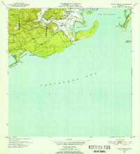
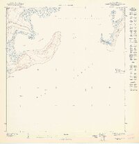
1952 Map of Punta Verraco
USGS Topo · Published 1953About this map
The coastal interface of southwest Puerto Rico is defined by the prominent headland of Punta Verraco and the industrial activity centered around Central San Francisco. Surveyed just after the war, this sheet illustrates the transition from the agricultural lowlands of the Río Yauco valley to the protected waters of the Bahía de Guayanilla. Small residential clusters like Parcelas Barrio Indio and Parada Lluveras are situated near the floodplain, while the southern coast remains largely undeveloped, characterized by the Bosque Insular de Guayanilla and recreational spots such as Playa de Tamarindo. Offshore, the presence of Cayo María Langa and Cayos de Caña Gorda indicates the complex reef and island systems vital to the local maritime environment. This record captures the region’s topography before the significant industrial expansions and modernization of the late 20th century.
Find a feature on this map
27 named features on this map. Tap any name to fly to it.
Don’t see what you’re looking for? This feature index may not catch every label — zoom into the map to look around manually.
Map Details
Editions of this 1952 Punta Verraco Map
2 editions found
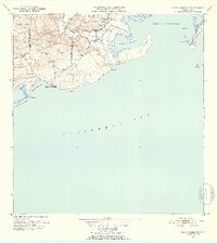
Other maps of this area

1937 · Sabana Grande
USGS Topo · 1:25,000

1938 · Guanica
USGS Topo · 1:30,000

1941 · Sabana Grande
USGS Topo · 1:30,000

1946 · Punta Cuchara
USGS Topo · 1:30,000

1946 · Yauco
USGS Topo · 1:30,000

1946 · Punta Verraco
USGS Topo · 1:30,000

1946 · Penuelas
USGS Topo · 1:30,000
1947 · Yauco SE
USGS Topo · 1:10,000
1947 · Yauco SO
USGS Topo · 1:10,000
1947 · Punta Verraco NE
USGS Topo · 1:10,000