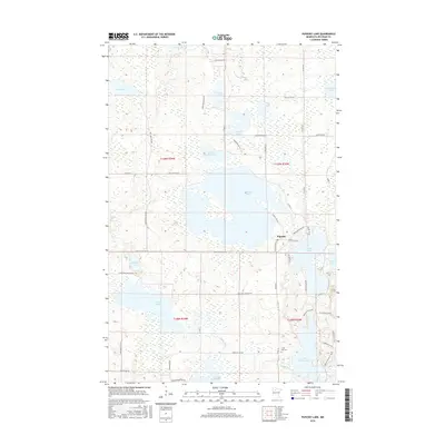
2016 Map of Puposky Lake
USGS Topo · Published 2016About this map
Puposky sits at the heart of this lake-heavy landscape in northern Minnesota, positioned at the narrows where Puposky Lake meets its northern extension. The terrain is a complex network of wetlands and interconnected water bodies, from the flow of the Mud River and Pike Cr in the north to the meandering path of the Turtle River in the south. This hydrologic pattern defines the local road network, where routes like Great Divide Rd NW and Puposky Rd NW navigate around the larger basins of Lake Julia and Little Turtle Lake.
Find a feature on this map
56 named features on this map. Tap any name to fly to it.
Don’t see what you’re looking for? This feature index may not catch every label — zoom into the map to look around manually.
Map Details
Editions of this 2016 Puposky Lake Map
This is the sole edition of this map. No revisions or reprints were ever made.
Other maps of this area

1919 · Solway
USGS Topo · 1:62,500

1920 · Buena Vista
USGS Topo · 1:62,500

1943 · Solway
USGS Topo · 1:62,500

1954 · Bemidji
USGS Topo · 1:250,000

1957 · Bemidji
USGS Topo · 1:250,000

1958 · Bemidji
USGS Topo · 1:250,000

1972 · Peterson Lake
USGS Topo · 1:24,000

1972 · Redby
USGS Topo · 1:24,000

1972 · White Fish Lake
USGS Topo · 1:24,000
1972 · Red Lake
USGS Topo · 1:24,000