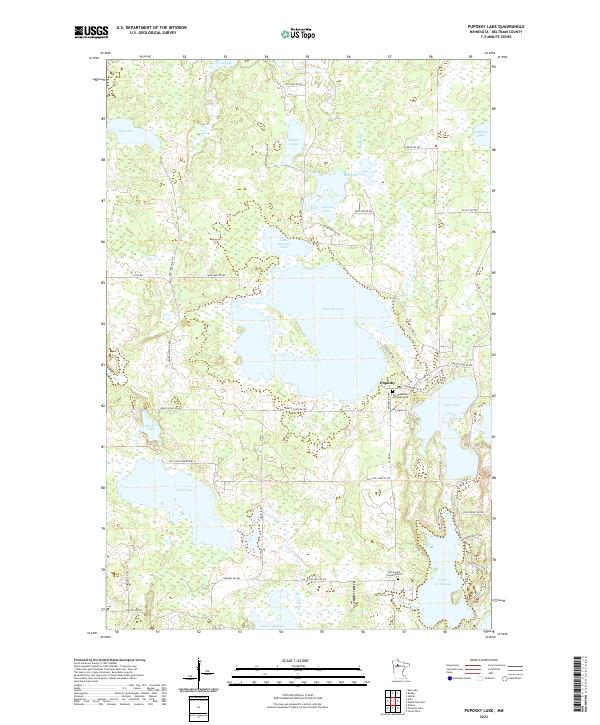
2022 Map of Puposky Lake
USGS Topo · Published 2022About this map
Puposky Lake and its smaller neighbor, Little Puposky Lake, dominate this northern landscape, forming a central hydrologic hub within the t149n r34w and t149n r33w townships. The settlement of Puposky sits along the southeastern shore, serving as a focal point for local families and genealogists who can trace heritage at Our Redeemer Lutheran Cem. The topography is defined by a dense network of water bodies, including Lake Julia, Rice Lake, and Long Lake, connected by corridors like the Mud River and Pike Cr. To the south, the Turtle River winds toward Little Turtle Lake, where the Turtle Lake Township Cem provides another critical touchstone for local history. This survey illustrates a post-glacial terrain where road networks like Great Divide Rd NW and Co Hwy 13 navigate around vast wetland basins and lake chains.
Find a feature on this map
58 named features on this map. Tap any name to fly to it.
Don’t see what you’re looking for? This feature index may not catch every label — zoom into the map to look around manually.
Map Details
Editions of this 2022 Puposky Lake Map
This is the sole edition of this map. No revisions or reprints were ever made.
Other maps of this area

1919 · Solway
USGS Topo · 1:62,500

1920 · Buena Vista
USGS Topo · 1:62,500

1943 · Solway
USGS Topo · 1:62,500

1954 · Bemidji
USGS Topo · 1:250,000

1957 · Bemidji
USGS Topo · 1:250,000

1958 · Bemidji
USGS Topo · 1:250,000

1972 · Peterson Lake
USGS Topo · 1:24,000

1972 · Redby
USGS Topo · 1:24,000

1972 · White Fish Lake
USGS Topo · 1:24,000
1972 · Red Lake
USGS Topo · 1:24,000