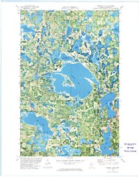
1972 Map of Puposky Lake
USGS Topo · Published 1974About this map
Puposky Lake dominates the center of this 1970s orthophotomap, showing a landscape defined by an intricate network of glacial lakes and wetlands in the Minnesota Northwoods. The small settlement of Puposky sits at the southern tip of the lake, serving as a focal point for the surrounding townships of Nebish, Maple Ridge, Durand, and Liberty. The transition from the lumber era to recreational and conservation land use is evident in the presence of the Long Lake State Wildlife Management Area and the Buena Vista Ski Area along Lake Julia.
Find a feature on this map
31 named features on this map. Tap any name to fly to it.
Don’t see what you’re looking for? This feature index may not catch every label — zoom into the map to look around manually.
Map Details
Editions of this 1972 Puposky Lake Map
This is the sole edition of this map. No revisions or reprints were ever made.
Other maps of this area

1919 · Solway
USGS Topo · 1:62,500

1920 · Buena Vista
USGS Topo · 1:62,500

1943 · Solway
USGS Topo · 1:62,500

1954 · Bemidji
USGS Topo · 1:250,000

1957 · Bemidji
USGS Topo · 1:250,000

1958 · Bemidji
USGS Topo · 1:250,000

1972 · Peterson Lake
USGS Topo · 1:24,000

1972 · Redby
USGS Topo · 1:24,000

1972 · White Fish Lake
USGS Topo · 1:24,000
1972 · Red Lake
USGS Topo · 1:24,000