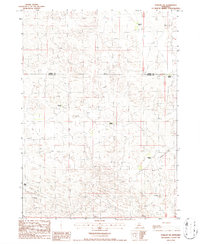
1986 Map of Purdum SW
USGS Topo · Published 1986About this map
The Sandhills landscape of Thomas County is defined by a sparse, ranching-based settlement pattern as recorded in the mid-1980s. This survey illustrates the isolation of the Nebraska interior, where the primary human footprint consists of widely dispersed homesteads such as McCreath Ranch and Fackler Ranch. The terrain is marked by a complex network of dunes and depressions, intersected only by a prominent Transmission Line and a few unimproved trails.
Find a feature on this map
9 named features on this map. Tap any name to fly to it.
Don’t see what you’re looking for? This feature index may not catch every label — zoom into the map to look around manually.
Map Details
Editions of this 1986 Purdum SW Map
This is the sole edition of this map. No revisions or reprints were ever made.
Other maps of this area

1948 · Thedford
USGS Topo · 1:62,500

1948 · Halsey
USGS Topo · 1:62,500

1948 · Seneca 4
USGS Topo · 1:62,500

1949 · Seneca 4
USGS Topo · 1:62,500

1949 · Purdum
USGS Topo · 1:62,500

1950 · Thedford
USGS Topo · 1:62,500

1950 · Halsey
USGS Topo · 1:62,500

1951 · Purdum
USGS Topo · 1:62,500

1954 · North Platte
USGS Topo · 1:250,000

1956 · North Platte
USGS Topo · 1:250,000