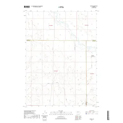
2017 Map of Purdum
USGS Topo · Published 2017About this map
Purdum sits at a geographic crossroads in the Nebraska Sandhills, marking a point where Blaine, Thomas, and Cherry Counties meet. The landscape is dominated by the winding course of the North Loup River, which cuts through the northern half of the quadrangle. This area serves as a transition point between the higher ranching lands and the riparian corridor of the river valley. The road network, including W North Loup Rd and Purdum Ave, illustrates how local transit followed the natural topography of the river basin. Family-named routes such as Atkins Rd, Rosehill RD, and Ryman Ln reach into the interior, reflecting the deep-rooted ranching heritage of the region. The map details the intricate elevation changes characteristic of this fragile prairie ecosystem, providing a precise record of the land use patterns along the river during the early 21st century.
Find a feature on this map
15 named features on this map. Tap any name to fly to it.
Don’t see what you’re looking for? This feature index may not catch every label — zoom into the map to look around manually.
Map Details
Editions of this 2017 Purdum Map
This is the sole edition of this map. No revisions or reprints were ever made.
Other maps of this area

1948 · Halsey
USGS Topo · 1:62,500

1949 · Purdum
USGS Topo · 1:62,500

1949 · Koshopah
USGS Topo · 1:62,500

1950 · Halsey
USGS Topo · 1:62,500

1951 · Dunning
USGS Topo · 1:62,500

1951 · Purdum
USGS Topo · 1:62,500

1951 · Koshopah
USGS Topo · 1:62,500

1954 · North Platte
USGS Topo · 1:250,000

1956 · North Platte
USGS Topo · 1:250,000

1957 · North Platte
USGS Topo · 1:250,000