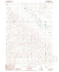
1986 Map of Purdum
USGS Topo · Published 1986About this map
The North Loup River winds through this section of the Nebraska Sandhills, defining the landscape where the borders of Cherry, Thomas, and Blaine counties meet. The small community of Purdum sits near the eastern edge, serving as a focal point in a region characterized by sparse settlement and extensive ranching operations. The map documents numerous family-owned holdings, including the Lowe Ranch, Johnson Ranch, and Moody Ranch, which are strategically positioned near water sources or along the valley floor.
Find a feature on this map
14 named features on this map. Tap any name to fly to it.
Don’t see what you’re looking for? This feature index may not catch every label — zoom into the map to look around manually.
Map Details
Editions of this 1986 Purdum Map
This is the sole edition of this map. No revisions or reprints were ever made.
Other maps of this area

1948 · Halsey
USGS Topo · 1:62,500

1949 · Purdum
USGS Topo · 1:62,500

1949 · Koshopah
USGS Topo · 1:62,500

1950 · Halsey
USGS Topo · 1:62,500

1951 · Dunning
USGS Topo · 1:62,500

1951 · Purdum
USGS Topo · 1:62,500

1951 · Koshopah
USGS Topo · 1:62,500

1954 · North Platte
USGS Topo · 1:250,000

1956 · North Platte
USGS Topo · 1:250,000

1957 · North Platte
USGS Topo · 1:250,000