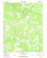
1963 Map of Purdy
USGS Topo · Published 1980About this map
The Nottoway River defines the landscape of the Virginia coastal plain, winding through the borderlands between Sussex and Greensville counties. At the heart of this rural corridor, the Purdy settlement serves as a focal point along the Norfolk and Western railroad. The map reveals a community structured around small crossroads and family landmarks, with Fields Crossroads and Cowie Corner anchoring the local road network. The terrain is a complex system of drainage, where Otterdam Swamp and Moores Swamp feed into larger arteries like Three Creek. Religious and educational life is well-documented through numerous landmarks such as Grace Ch, Little Shiloh Ch, and the Mayo Sch. For genealogists and local historians, the inclusion of named cemeteries like Harrison Cem and the remote Cowie Cem provides essential spatial context for 20th-century family history in the Tidewater region.
Find a feature on this map
29 named features on this map. Tap any name to fly to it.
Don’t see what you’re looking for? This feature index may not catch every label — zoom into the map to look around manually.
Map Details
Editions of this 1963 Purdy Map
3 editions found
Other maps of this area

1919 · Jarratt
USGS Topo · 1:62,500

1919 · Mc Kenney
USGS Topo · 1:48,000

1919 · Emporia
USGS Topo · 1:62,500

1919 · Arringdale
USGS Topo · 1:48,000

1920 · Arringdale
USGS Topo · 1:62,500

1921 · Mc Kenney
USGS Topo · 1:62,500

1942 · Arringdale
USGS Topo · 1:62,500

1942 · Emporia
USGS Topo · 1:62,500

1943 · Mc Kenney
USGS Topo · 1:62,500

1951 · Jarratt
USGS Topo · 1:62,500