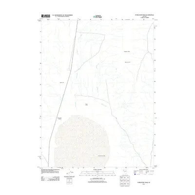
2011 Map of Purgatory Peak
USGS Topo · Published 2011About this map
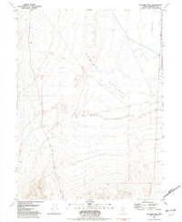
Purgatory Peak and Mount Limbo dominate the eastern high ground of this Nevada desert landscape, overlooking a series of seasonal drainage systems that carve through the arid terrain. The northern reaches of the Winnemucca Lake bed occupy the southern portion of the sheet, providing a clear view of the basin's floor as it appeared in 2011. This area is characterized by significant elevation changes, from the alluvial fans of the Poito Valley to the steep relief of Threemile Canyon. Jayhawk Creek and Jenny Creek trace paths across the flats, illustrating the hydrology of the Great Basin where water flows intermittently toward the terminal lake bed. To the west, Falcon Hill rises as a distinct landmark above the valley floor, marking the transition between the basin depths and the surrounding ranges.
Find a feature on this map
8 named features on this map. Tap any name to fly to it.
Don’t see what you’re looking for? This feature index may not catch every label — zoom into the map to look around manually.
Map Details
Editions of this 2011 Purgatory Peak Map
This is the sole edition of this map. No revisions or reprints were ever made.
Other maps of this area

1886 · Granite Range
USGS Topo · 1:250,000

1894 · Granite Range
USGS Topo · 1:250,000

1955 · Lovelock
USGS Topo · 1:250,000

1959 · Lovelock
USGS Topo · 1:250,000
1964 · Tohakum Peak NE
USGS Topo · 1:24,000

1964 · Tohakum Peak NW
USGS Topo · 1:24,000

1964 · Kumiva Peak
USGS Topo · 1:62,500
1981 · Tunnel Spring
USGS Topo · 1:24,000
1981 · Betty Creek
USGS Topo · 1:24,000
1981 · Jayhawk Well
USGS Topo · 1:24,000